

Map of Utah, showing 5 National Parks (NP) in southern part of the state. This map also shows the National Monuments (NM), National Recreation Areas (NRA), and National Historical Sites (NHS) in Utah. 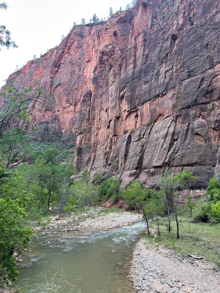
Zion National Park. The Virgin River leads the hiker back to the temple of Sinawava. A relatively easy hike. Sinawava is the coyote spirit of the Paiute Nation. 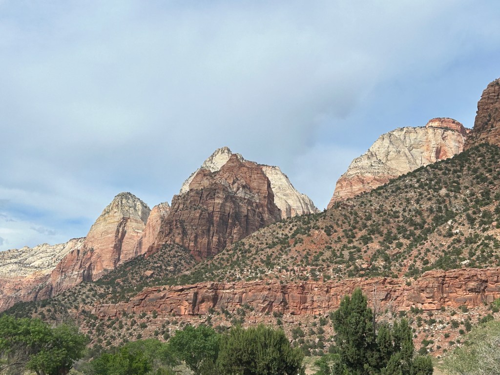
Zion National Park. A bus takes you through part of the park, to save traffic congestion and pollution. This view is from the bus. 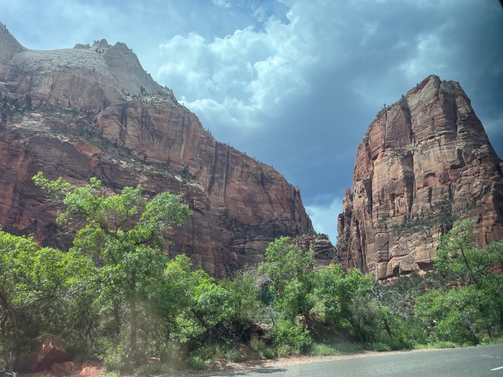
Zion National Park. Majestic canyons formed by the Virgin River. 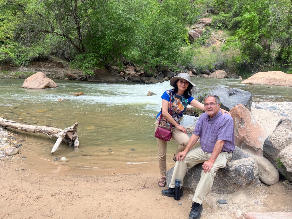
Zion National Park, the third most visited park in the National Park system. This is a brief stop along the “riverwalk” hike. 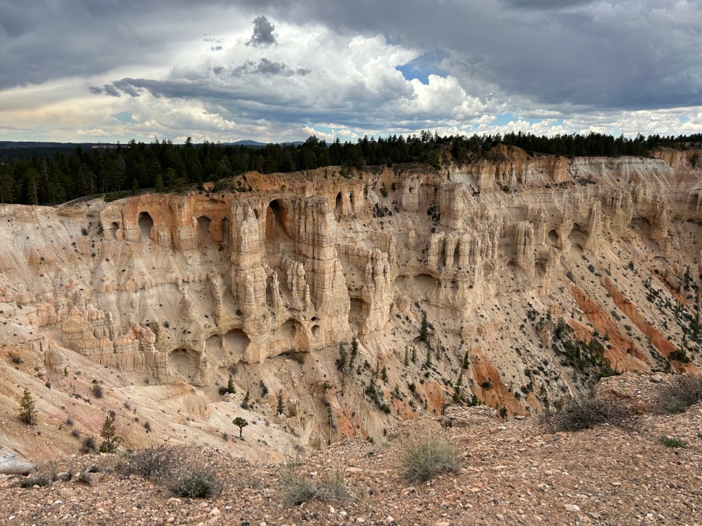
Bryce Canyon National Park. What the weather will eventually do to your face if you stay out in it long enough. 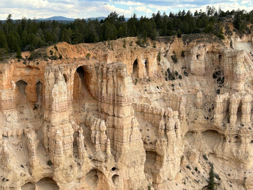
Bryce Canyon National Park. Different colors of rock representing different geological eras. 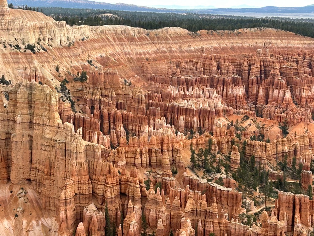
Bryce Canyon National Park. The park is full of spires called “hoodoos.” They are formed from water freezing between rocks, eroding them over time. 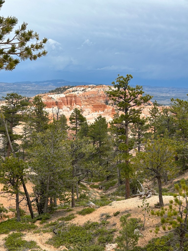
Capitol Reef National Park. 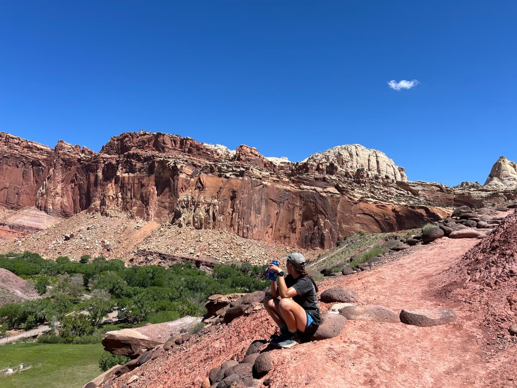
Capitol Reef National Park. A fellow, anonymous hiker takes a break to enjoy the vista on the Cohab Trail. 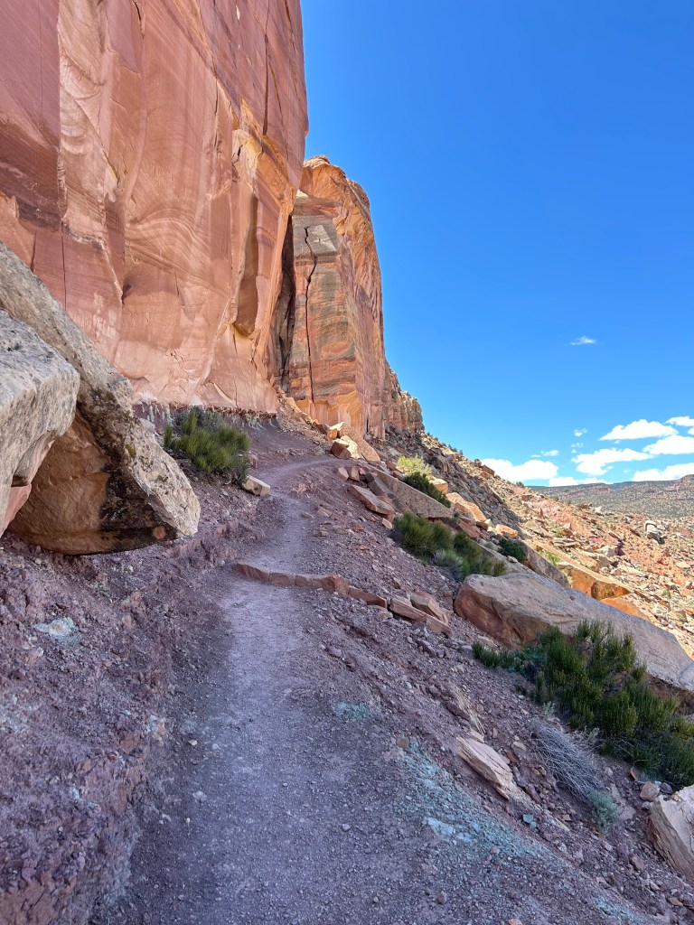
Capitol Reef National Park. Part of the Cohab Canyon Trail. Jie stayed behind, not liking all the climbing and the drop offs. But it was safer than it looks. 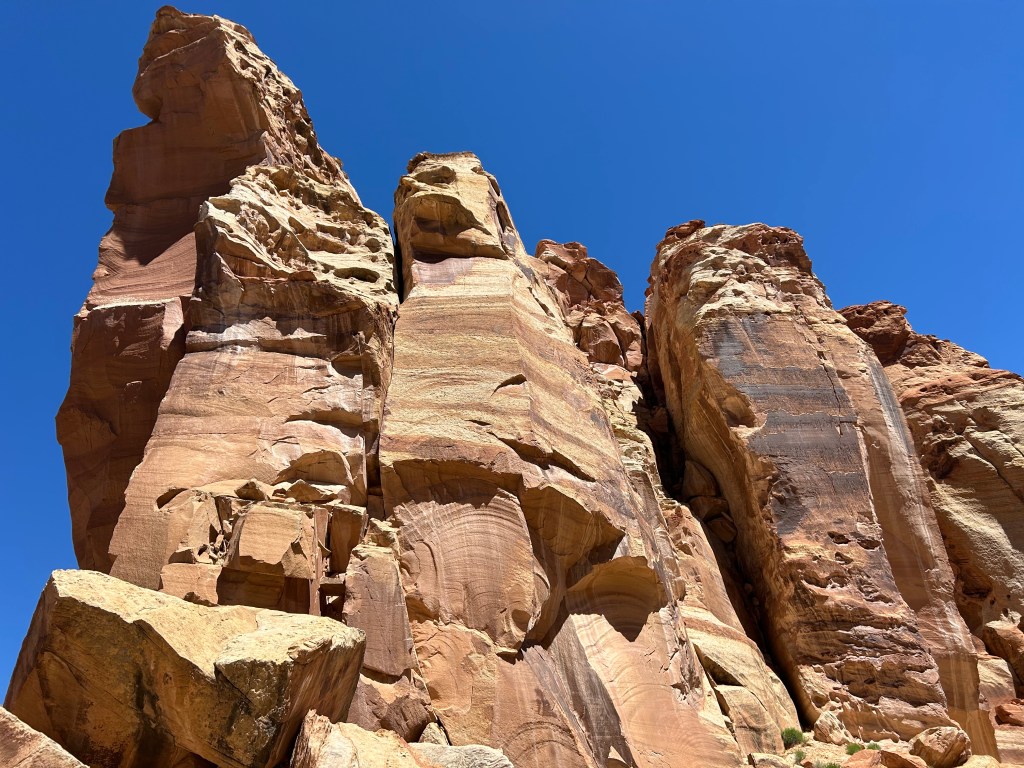
Capitol Reef National Park. Some of the sights from the Cohab Canyon Trail, an up and down of 400 feet. 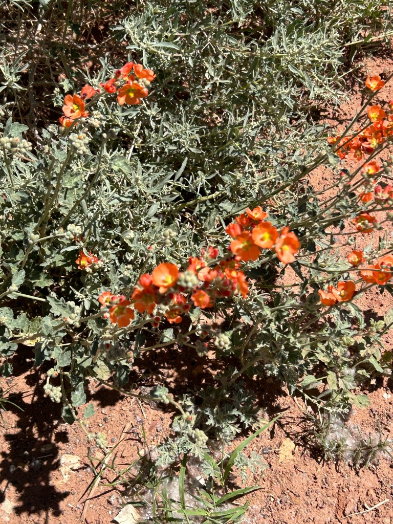
Globemallow: beautiful orange flower found all through southern Utah on this month of May trip. 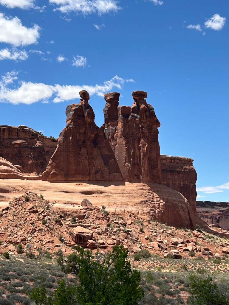
Arches National Park. The Three Gossips. I couldn’t get close enough to hear what they were saying. 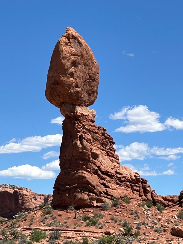
Arches National Park. Balanced Rock. A 128 foot tall structure, a block of sandstone sits on top of a block of eroding mudstone. It weighs 3577 tons, although I don’t know why I’d need to know that. 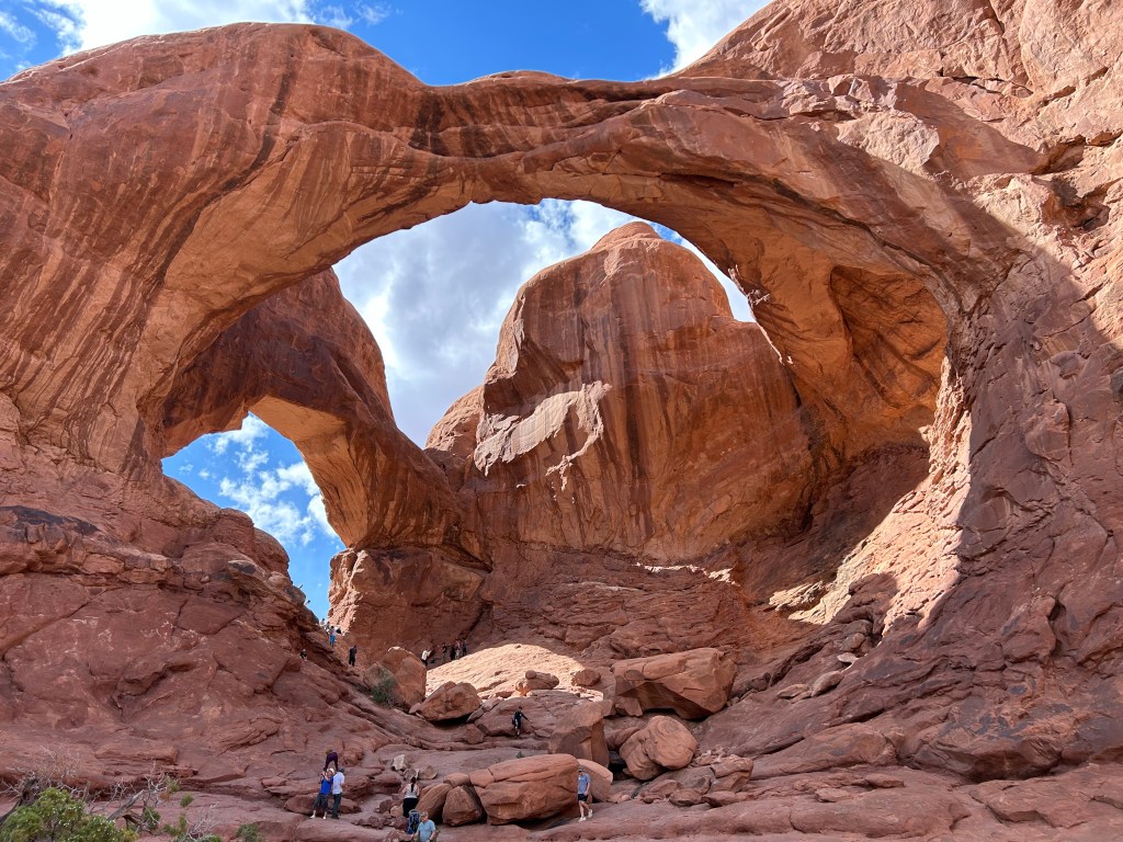
Arches National Park: the Double Arch. This is enormous in its size. I enjoyed just sitting there on a boulder, taking it all in 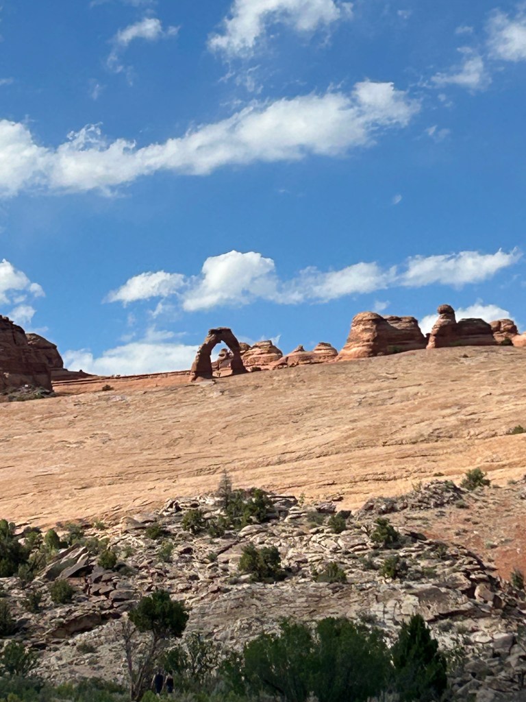
Arches National Park. While the park has more than 2000 arches, this is the most famous, known as the “Delicate Arch,” pictured on Utah license plates, National Park Service publications, etc. It is free-standing and survives in a field of other geological litter. 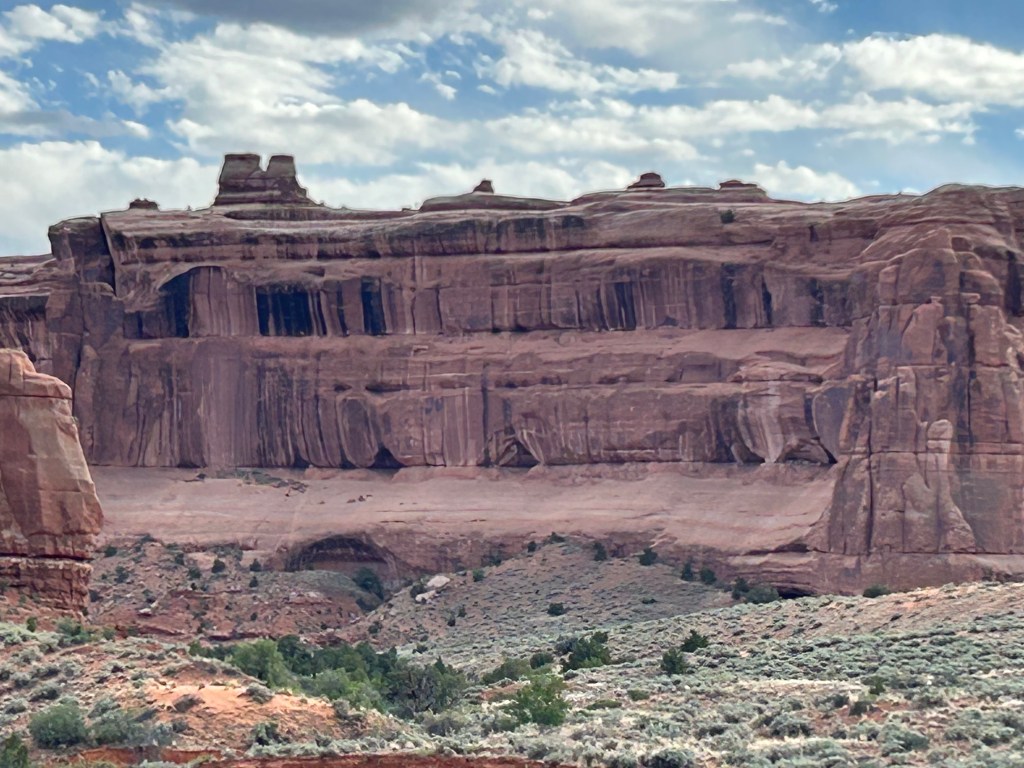
Canyonlands National Park–colors and shapes millions of years in the making. 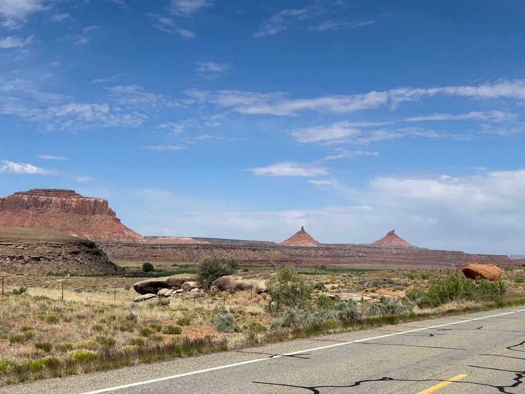
Canyonlands National Park: erosion creates all sorts of shapes. 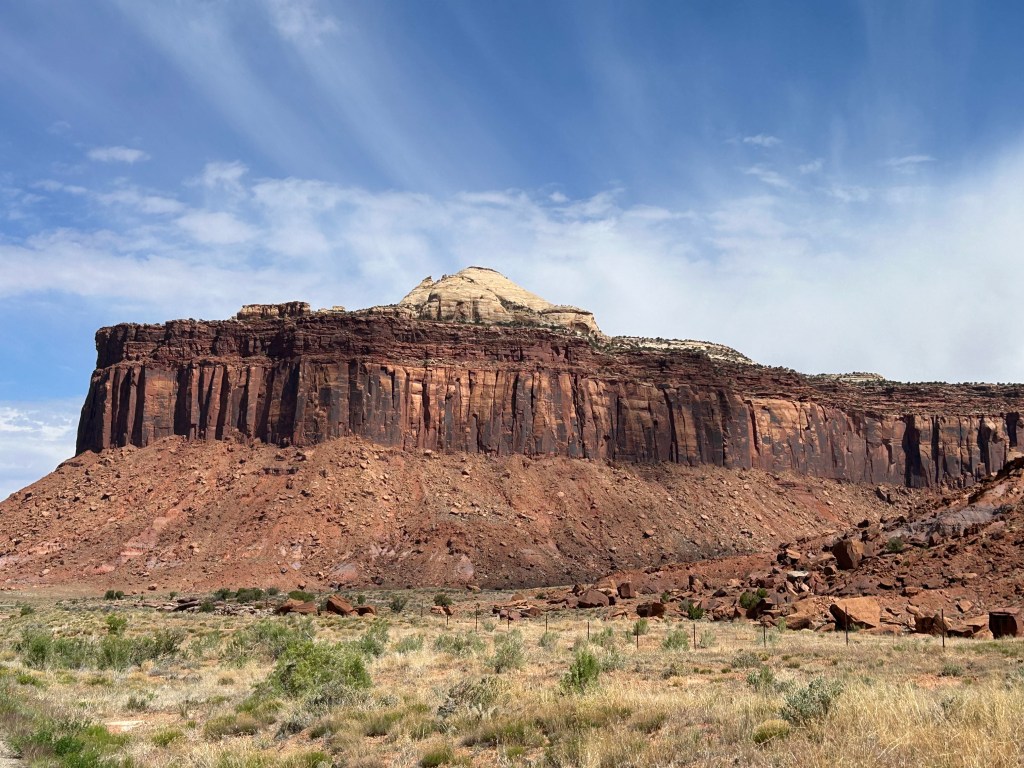
Canyonlands, carved out by the Green River 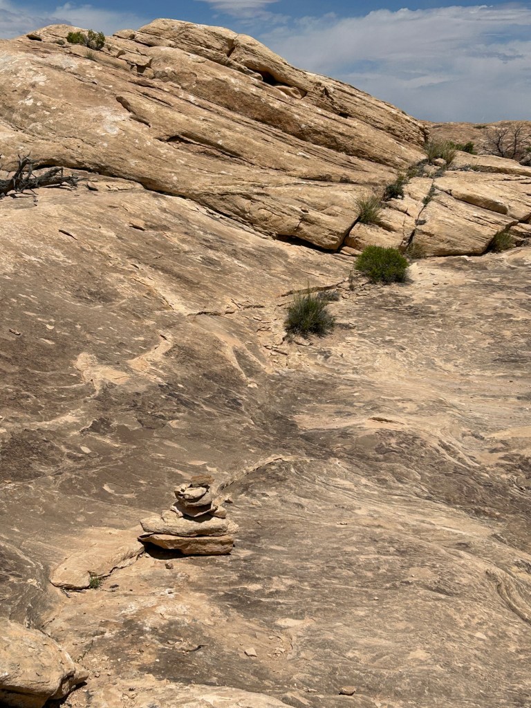
Slickrock Trail in the Canyonlands. Little piles of rocks guided us up and down the trail, over and around.
My first visit to Utah was in 1994, on a family trip to California when Mindy and Alison were 12 and 10. Driving west from Illinois—through Colorado, across the Rockies, and into Utah—it seemed the strangest place I’d ever set eyes upon. A land of dried-up ocean beds, volcanic debris, wrinkles in the earth’s crust, desert, snow-topped mountain ranges, deep canyons, and bizarre rock formations—Utah’s geography was stunning.
I’ve gone back several times, most extensively once to travel with my daughter Mindy on the occasion of her college graduation. On that trip we took in two of Utah’s National Parks: Zion and Bryce Canyon. While in Bryce Canyon, we trusted our lives to mules as they bore us safely along the edges of steep drop-offs and into its valleys. For twenty years I’ve wanted to go back and check out all five of the state’s National Parks: Zion, Bryce Canyon, Capitol Reef, Arches, and Canyonlands. Since Jie had never been to Utah, it was a chance for her to experience the place for herself.
We flew to Las Vegas on May 13 and rented a car for our explorations. With Utah’s rural wonderlands on my mind, Las Vegas was merely a necessary nuisance, and I had no mood for being there. It turned out that Las Vegas was in no mood for me either. They greeted us with hidden fees ($200 extra dollars for the car rental, $120 extra dollars for one night in a motel, $7 coffee for breakfast) and the normal chaos you encounter when driving in from the airport at 10 p.m.
The next morning, however, we escaped that Looney-Town and headed toward the national parks. Our first stop would have been Mukuntuweap National Park, except they changed the name before we arrived. Actually, they changed the name in 1918 because the U.S. government thought no self-respecting Christian would visit a park with an Indian name. So they made it a biblical name: Zion.
Zion National Park is filled with cliff and canyons carved by what was once the Adams River. The river is still there, but its name too got changed. Named for President John Quincy Adams—the Andrew Jackson administration changed the name to punish the former president. Adams and Jackson got along with each other about as well as Biden and Trump. (There are several historical similarities!) The river’s new name was “Virgin,” in honor of Thomas Virgin, a hapless explorer and Indian fighter, who kept getting himself wounded–and eventually killed due to his escapades. But the river in Zion doesn’t seem to mind what people call it–it just keeps gouging out canyons, moving boulders around, and forcing people and animals to pay attention to its wild extremes.
All in all, once you get over some of the names—the place takes your breath away with its grandeur and power. It is the third most visited National Park in the country, behind The Smokie Mountain National Park and Grand Canyon.
After hiking Zion’s Riverwalk trail, we headed to our motel for the night in Cedar City, Utah—a Super-8–no hidden fees. The next day we took a winding, mountainous road to Bryce Canyon, about a ninety minute trip. Bryce Canyon is smack in the desert and filled with hoodoos. I rank it one of my two or three favorite National Parks. (I’ve been to 33 of the 63.) Once an ancient seabed, the area accumulated eon after eon of silt, much of it pressed into various types of stone: limestone, mudstone, siltstone, and dolomite. When the Rocky Mountains popped up, mostly in nearby Colorado, Utah went along for the ride—getting jacked up almost two miles above sea level. Unfortunately, Utah rose at a slight tilt, causing all the water in its ancient seas to drain into the Pacific Ocean. Over time, intermittent freezing and thawing—along with wind—wore down the stones—at different rates depending on the type of rock. What is left are strange remains—known as hoodoos. I’ve never seen anything like it.
After a day riding the park bus and hiking in Bryce Canyon, we headed to Salina, Utah, a two hour drive. Our home for the next two nights was in the High Desert Inn, a simple, delightful, family run motel. You could walk one block to Mom’s Restaurant for a nice meal. Salina got its life from coal mining in the area, its name from the salt refinery there, and its continued existence as a transportation center when Interstate 70 was routed nearby. In World War II, it was a POW camp housing Germans from Erwin Rommel’s Afrikakorps.
We headed out from our base in Salina to visit our third national park: Capitol Reef. The park has good homemade pies. They sell them at the Gifford Homestead—but you have to get there before noon—before they run out. I ate one (a small one) just before I headed up the mountain on the Cohab Canyon Trail. Jie didn’t eat enough pie and wasn’t able to handle the trail—so she took a nap until I returned.
Capitol Reef is named for a prominent dome in the park that looks like the dome of the U.S. Capitol. The park dome is made of Navajo sandstone. The “Reef” in the park’s name comes from a north to south mountain range that seemed impenetrable to early travelers—“reef” meaning “barrier.” That range was caused by a wrinkle in the earth’s crust. Along with my pie-fortified hike, we did the short Goosenecks Trail that day, driving to the top of the canyon and looking down 800 feet at Sulphur Creek, shaped like a goose’s neck as it curved and cut its way through stone below.
We headed back to the Salina for dinner at Mom’s and a good night’s rest. The next day we bid the town farewell and left for Arches National Park. There are 2000 arches throughout the park—as well as additional arches outside its boundaries. Someone decided that the base must be at least three feet wide in order to qualify as an “arch.” Landscape Arch has the widest base—306 feet. We took several hikes that day: to Balanced Rock, North and South Arch, Double Arch, Turret Arch, and Delicate Arch. That night we drove an hour to our motel (for a two-night stay) in Monticello, Utah. We found a Japanese chef down the block and enjoyed sushi at hi restaurant that night.
The final National Park Day was at Canyonlands National Park, another hour away from Monticello. Our hike there was in the Needles section of the park, on the Slickrock Trail—a moderately strenuous two-mile trek. This park was carved out by the Green and Colorado River. It resembles Grand Canyon. The Slickrock Trail had us climbing up slabs of rock and twisting around boulders. We got to see the canyon from above and below. Along the way, little piles of rocks were set up every 50 feet or so to let us know where to hike next.
At the end of that last day, we stopped by a local grocery store–at their salad bar–and carried away a picnic supper. We then walked around the streets of Moab, Utah and visited some of the arts and crafts shops–until they closed–then headed back to the motel for the night. The next day, we drove back to Las Vegas–while I fought off some sort of allergies all day. I can’t figure out what caused all the runny nose and misery–except perhaps the thought of going back to a city where people sit at slot machines all day and lose their money–and then go back home and complain about how bad the economy is.
Utah’s five National Parks (Zion, Bryce Canyon, Capitol Reef, Arches, and Canyonlands) are all in the southern part of the state—along a 450 mile route. They can be seen by car and short (easy) hikes—while staying in comfortable motels at night. OR—you can take strenuous hikes and camp in the park overnight. Kayaking, white water rafting, and mountain climbing are available if it’s your thing.
We flew home on May 21. As always, glad to be back in my own bed and regaling friends and family with my latest adventures.
